
Service Areas
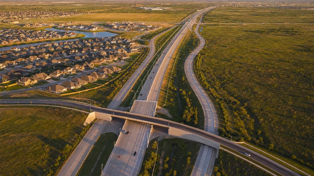
General Contractor on the Fort Bend Grand Parkway Growth Corridor
Developers buying land ahead of the next Grand Parkway segment need a builder who can price roads, utilities and detention against a highway that does not yet exist, and that is the planning discipline we apply across the Fort Bend growth corridor. The right parcel before a new interchange is worth more after it, but only if the site work, access and phasing are designed for the road that will be there, not just the one that is.
The West Houston Association reported on July 28, 2026 that Grand Parkway Segment C is approximately 26 miles long from I-69/US 59 in Sugar Land to SH 288 near Rosharon, that Fort Bend commissioners acted in May 2026 to let TxDOT advance Segments C-1 and C-2, and that the estimated investment for Segment C and its direct connectors could approach $1.5 billion. TxDOT's design-build page for Segment C-1 describes four new SH 99 tolled lanes for approximately 9.7 miles from Interstate 69 South to FM 762, with seven direct connectors at the I-69 South interchange and four at Fort Bend Parkway. Schedules for a project of this size change, so we rely on the current official documents when we price.
The site development and utilities and mass grading trade partners prepare land for retail, school, medical, multifamily and industrial buildings, and we build on it.
Designing for the road that will be there
A parcel that will front a new tolled lane, a frontage road or a direct connector changes in value and in constraints. Access points, driveway spacing, right-of-way dedication, drainage outfalls and utility corridors may all shift. We study the agency's plans with the owner's civil engineer, mark the likely right-of-way on our site layout and avoid building anything permanent in its path.
That approach also supports phasing. The first phase can be positioned where access already exists, with later phases sized for the future frontage. The owner sees a layout that grows with the road instead of a layout that has to be demolished when the road arrives. Where a utility district or county is building roads, we coordinate construction schedules so our work does not undercut or duplicate theirs. Spending twice on the same driveway is a common and avoidable loss on corridor projects.
Why growth here is infrastructure-led
The West Houston Association reported on September 19, 2024 that Fort Bend County is expected to double in population by 2050, that about 50% of the people who live in Fort Bend work in Houston, and that key projects include Grand Parkway Segment C, the Missouri City Park and Ride and the extension of the Westpark Toll Road to Fulshear. Where half the residents commute, roads shape where homes, shops and offices go, and roads are what we watch.
Community Impact reported in October 2024 that the $53.6 million direct connectors between the Westpark Tollway and northbound Grand Parkway, funded by the Fort Bend County Toll Road Authority, Fort Bend County and local districts, would open in mid-October 2024 after more than two years of construction. That timeline is a useful benchmark for any owner expecting connector or interchange work near a site: multi-year construction with phased openings, and traffic patterns that change as each piece opens.
What gets built along the new roads
Growth corridors need community-serving buildings first. Retail centers with groceries and pharmacies, medical office, schools, daycares, fitness and restaurants follow rooftops. Our retail shopping center scope covers the pads and in-line space, while our school construction service delivers campuses on tight district schedules. Multifamily and mixed-use buildings arrive near the interchanges.
Industrial development follows the highways too, and the interchange areas between I-69 and SH 288 are candidates for warehouse and flex buildings. Sites vary widely: some are near existing development with utilities at the lot line, others are open farmland that needs a district to supply water and sewer first. We help owners understand the cost difference before they buy.
Utility districts, permits and timing
Many Fort Bend parcels sit in municipal utility districts, which finance water, sewer and drainage through bonds and have their own approval steps. Dates for district construction, acceptance and connection can control when a building can open. We ask the district's engineer for the schedule early and build our permit and construction calendar around it, and we recommend that owners hold a coordination meeting before design is complete.
Our permitting and entitlements team tracks plats, site plans and utility reviews through the multiple agencies that can touch a corridor project: county, city, district and state. The earlier those requests go in, the less likely a gap appears between building completion and the ability to open.
Where this fits among our Fort Bend work
The corridor links several communities. For existing built-up areas, see our pages for Sugar Land and Missouri City, and for the southwestern end see Rosenberg and Richmond. Land developers will find our approach on the page for commercial real estate developers.
Whatever the parcel, our advice is the same: get the survey, the flood determination and the utility district's capacity letter in hand before you commit capital. Those three documents explain most of what a corridor site will cost, and each is cheaper to obtain before closing than after. We read them with the owner, flag the items that could move the budget and say plainly when a parcel is more expensive to develop than its price suggests.
Show us the parcel and the highway map
Send the site, the road plans you are relying on and your phasing goals. We will return a site and building budget that accounts for the future frontage.
Common Questions
Should I wait for the highway before I build?
It depends on your use and your lender. Retail and services often want to open before the road improves traffic, while distribution users may wait for access. We can phase the site so that the first building works today and later phases take advantage of the road.
How do I allow for right-of-way that is not yet acquired?
Study the agency's concept plans, mark the likely corridor on your site plan and keep permanent improvements out of it. Ask the agency about acquisition schedules and access rules. We help build that into the layout.
What do municipal utility districts mean for my timeline?
They often supply water, sewer and drainage, and they have their own approvals and construction schedules. Your building may not open until the district completes and accepts its work. We coordinate with the district's engineer to avoid surprises.
Can a school or shopping center open while roads around it are under construction?
Yes, with careful traffic planning. We design temporary access, signing and drop-off arrangements and coordinate with the road contractor. Opening dates should assume some disruption.
How do you price land development before the engineering is finished?
We use unit costs for grading, utilities and paving applied to the best available site data, then refine as the design develops. The early number is a range, and we say what could move it.