
General Contracting Services
Site Development and Utilities in Houston
Half a cubic foot per second per acre. That is the outflow the City of Houston allows from a developed site in a two-year storm, rising to two cubic feet per second per acre in a hundred-year event, and it is the number that decides how much of your parcel becomes a pond. Everything else in site development, from the mass grade to the storm sewer to the elevation of the first slab, follows from it.
Site development and utilities is the least glamorous part of a project and the part that most often sets its schedule. Before a building can start, the land has to be cleared, graded, drained, served by water, sanitary sewer and power, and connected to a road, all under the eyes of whichever city, county, district and utility owns each piece.
Here is how we organize that work around Houston: what we build, the soils and the rules that shape it, and how we sequence the pond, the pipes and the pad.
Land that drains slowly and a map of authorities
The ground is flat and clay-heavy. Houston sits on unconsolidated clays and shales, only about 50 feet above sea level downtown, with an extensive built drainage system doing the work the terrain does not. Some Fort Bend soils are very deep and very slowly permeable, with 45 to 60 percent clay, cracks that open a foot or more when dry and swell shut when wet. Water does not leave these sites quickly, and neither does a construction crew on a wet week.
Authorities layer on top of one another. A site may sit in the City of Houston, a smaller city, its extraterritorial jurisdiction or unincorporated Harris County, and it may also fall in a municipal utility district, a drainage district or a flood control district. Each controls some of the approvals. We begin with a one-page authority map for the site, so no one is surprised by an extra review.
Detention, floodplain and the permit sequence
City of Houston detention rules are based on the size of the tract, not the lot, and an update to the drainage manual dropped the old detention curve and added a redevelopment credit. Floodplain development permits are required for any construction in the 500-year or 100-year floodplain or the floodway, and structures must be two feet above the 500-year elevation, or three feet for critical facilities and floodway locations.
In unincorporated Harris County, the floodplain regulations take over. Under a Class II permit for development in the 100-year floodplain, the lowest habitable floor must be 24 inches or more above the 500-year elevation or 12 inches above the nearest public street crown, fill to raise structures is prohibited, and any loss of storage in the 500-year floodplain must be offset one to one. A site plan that ignores that last rule can give up a surprising share of its buildable area. We read these requirements before we price, and we sequence permits so the pond can be dug early.
The work, in the order it is built
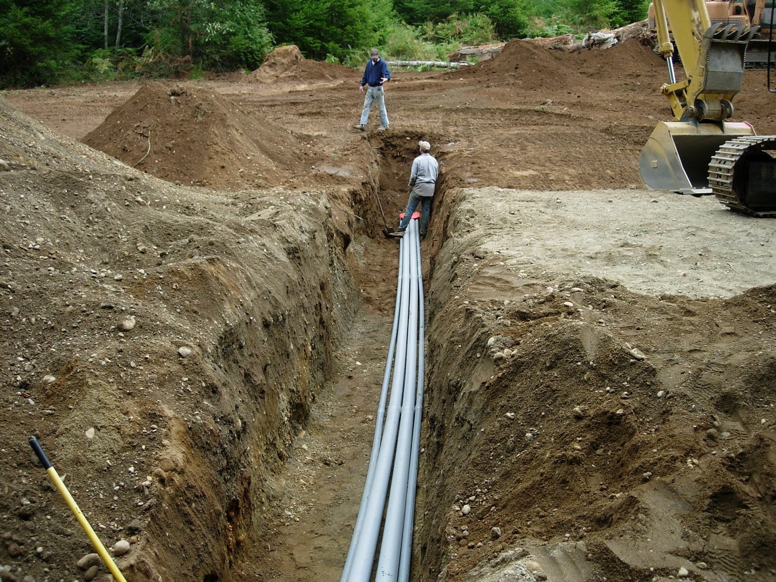
Site development begins with clearing, erosion controls and a stabilized construction entrance. Mass grading follows, with cut and fill balanced where possible and unsuitable soils removed or treated. Detention is typically built next, since the pond must function during construction as well as after, and then comes the underground utility work: storm sewer, sanitary sewer, water lines and fire lines, with services to each building and conduits for power and communications.
Finally, we place the base for pavement and set the building pad to elevation. Sites with rail or truck traffic need concrete drive lanes and aprons, which our truck courts and dock aprons and parking lot construction services provide. Grading as a separate discipline is described under our mass grading service, and drainage under stormwater and drainage.
Utilities, ready or not
Whether utilities are in place may be the biggest question for a new industrial site. Some parks are built for ready use: Conroe Park North, for example, is a city-owned 1,655-acre park with four-lane concrete streets and city water and sewer already in place. Other parcels sit beyond the end of a main or need a lift station, an off-site extension or a larger line to deliver fire flow.
We ask for utility availability letters at the start and test them against the building's demand. Fire flow and sanitary capacity are the two that most often fail. When an off-site extension is needed, it may run through easements, across roads or under other utilities, each with its own permit, and its time and cost belong in the project baseline. Our Conroe Park North page describes the pattern in a park where the infrastructure is ready.
Sequencing the pond, the pipe and the pad
We plan site work in the dry months when we can, and we protect it when we cannot. Earthwork stops when soils are saturated, and a pad left unprotected for a week of rain can need rework. We stage open trenches, keep pumps and sediment controls ready and close trenches daily. Hurricane season changes the plan further: open excavations are secured, loose materials are removed and basins are checked before a forecast storm.
The critical path usually runs through the permits, the detention, the underground utilities and the pad. We prepare a short schedule for each, then watch them closely. The owner's building schedule starts when the pad is released, so every day gained on the site is a day gained overall. Our design-build delivery and preconstruction estimating services bring site decisions forward.
What we keep close
We keep the earthwork, utilities and paving coordination under direct supervision, and we use specialty subcontractors for tasks such as boring, lift stations and heavy dewatering. The reason is simple: the site is where the weather and the schedule collide, and a single point of control helps. Owners in logistics and distribution and public sector projects see the benefit most, since both often involve large paved areas and extensive utilities.
Bring us the parcel
Bring us the parcel and the authority map, and we will lay out the pond, the pipe and the pad in order, with permits and utility letters on the critical path where they belong.
Common Questions
How big will the detention pond be?
It depends on the tract size, the amount of impervious cover, the allowable outflow and the local drainage manual. The City of Houston ties detention to the tract and has recently added a redevelopment credit, while other jurisdictions apply their own criteria. A civil engineer sizes the pond, and we price the excavation, the outfall and the maintenance access.
Can we use fill to raise a building out of the floodplain?
In unincorporated Harris County, fill to elevate structures in the 100-year floodplain is prohibited under the county's regulations, and storage lost in the 500-year floodplain must be offset. Inside the City of Houston, different standards apply. Either way, we confirm with the reviewer before grading is planned.
How long do utility extensions take?
The time depends on the owner of the line, the length, the easements and the review queue. Short connections may take weeks, while off-site extensions with easements can take months. We start them at the beginning of the project and track them as critical items.
What happens when it rains during mass grading?
Work stops on saturated soils, the site is shaped to shed water and erosion controls are checked. We build rain days into the baseline and keep a plan to resume. Over-working wet clay creates more delay than waiting.
Do you coordinate with the franchise utilities for power and gas?
Yes. We submit load letters and site plans early, coordinate trenching and conduit and follow up on energization dates. Those utilities set their own schedules, so we make the dates visible.